In this illustrated talk, Tony Kirby will explore how both city and county have been mapped over the centuries, from the very generalised maps of the early Middle Ages , the productions of private surveyors from Tudor times onwards and through the 19c Ordnance Survey to the maps we take for granted today, whether Google or Satnav, who the map makers were, why the maps were produced and what they can (and can’t) tell us about the county’s history.
Until his retirement, Tony Kirby was Co-ordinator of Strategic & Curriculum Planning at Anglia Ruskin University, having previously been Principal Lecturer in History at what was, when he first started work there in 1970, ‘The Tech’. He was Co-President of the Cambridge Antiquarian Society 2022-24, and is a former Chair of the Cambridgeshire Records Society, Secretary of the Cambridgeshire Association for Local History and the Cambridgeshire County Advisory Group on Archives and Local Studies.
He was a lead compiler for the Historic Towns Trust Historical Map of Cambridge (2024) and for the current series of early 20c 25” OS maps of Cambridgeshire being published by Alan Godfrey Maps.
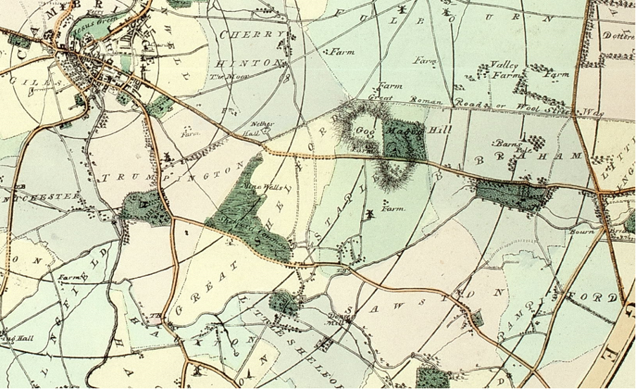
Alexander Watford and James Richardson: detail from Map shewing the Roads and boundaries of Parishes for the distance of Eight Miles around the University of Cambridge (1827)
Courtesy of Cambridge Antiquarian Society
This talk takes place on Zoom. Details will be sent to our Mailing List the day before the talk.
Date Tuesday 13 January 2026
Time 7:30pm – 9pm
Location Zoom
Cost Free
Note this talk replaces the previously advertised talk from Claire Martinsen that will now take place later in the year.
You can watch the recording of the talk here or on our YouTube channel.